Search
Alphabetical index
a palace in Wilanów
Babice
Bagieniec
Baranów Sandomierski
Barciany
Bardo
Barwałd Górny
Baszków
Bąkowa Góra
Besiekiery
Będzin
Białaczów
Białawoda
Biecz
Biedrzychowice
Bielsko-Biała
Bierutów
Bobolice (Lower Silesian province)
Bobolice (Silesia Province)
Bobrowniki
Bobrów
Bobrów Castle
Bochotnica
Bodzentyn
Bolczów Castle
Bolesławiec (Łódz Province)
Bolków
Bolmin
Borów Polski
Borysławice Zamkowe
Borzygniew
Bożków
Brok
Bronów
Brzeg
Bychawa
Byczyna
Bydlin
Bytów
Chełmo
Chęciny
Chlewiska
Chobienia
Chocianowiec
Chocianów
Chocz
Chojnik Castle
Chojnów
Chudów
Chwarszczany
Ciechanowice
Ciechanów
Ciepłowody
Cieszków
Cieszyn
Cisy Castle (of the Cis family)
Czarny Bór
Czchów
Czemierniki
Czerna
Czernina
Czersk
Częstochowa
Człuchów
Czoch Castle
Czorsztyn
Czyżów Szlachecki
Decjusz’s Villa
Dęblin
Dębno
Dobczyce
Dobra
Domanice
Dunajec Castle
Dzierżoniów
Dzietrzychowice
Dziewin
Frombork
Frydman
Giebułtów
Głogów
Głogówek
Gniew
Gniewoszów
Gola
Gola Dzierżoniowska
Golczewo
Golub-Dobrzyń
Gołuchów
Gorzanów
Gościszów
Góra
Górka Castle
Grodno Castle
Grodziec (Lower Silesia Province)
Grodziec (Silesian Province)
Grodziec Castle
Gryf Castle
Gryfów Śląski
Grzędy (Wojaczów)
Grzmiąca
Henry's Castle
Iłża
Janowice Wielkie
Janowiec
Jawor
Jelcz-Laskowice
Jelenia Góra
Jelenia Góra-Sobieszów
Jeżów (Wilczyska)
Jędrzychów
Kamieniec
Kamieniec Ząbkowicki
Kamienna Góra
Karpień Castle
Karpniki
Karpno (Lądek Zdrój)
Kazimierz Dolny
Kąty Wrocławskie
Kętrzyn
Kliczków
Kłaczyna
Kłodzko
Koło
Konradów Castle
Kozienice
Kozłówka
Koźmin Wielkopolski
Kożuchów
Kórnik
Kraków
Kraków
Kraków – Branice
Krasków
Krąg
Krobielowice
Krosno Odrzańskie
Krupe
Krzyżtopór Castle
Książ Castle
Książ Wielki
Kurozwęki
Kwidzyn
Lanckorona
Legnica
Lidzbark Warmiński
Lipa
Lipowiec Castle
Liw
Lubin
Lublin
Lubliniec
Lwówek Śląski
Łęczyca
Łodygowice
Łupki (Wleński Gródek)
Maciejowa (Jelenia Góra)
Malbork
Melsztyn
Melsztyn Castle
Mieroszów
Międzygórz
Międzylesie
Międzyrzecz
Mirów
Mirów Castle
Modła
Mokrsko Górne
Myślenice
Nawojowa
Nidzica
Nieborów
Niedzica
Niesytno Castle
Nowy Dwór Castle
Nowy Jasiniec
Nowy Sącz
Nowy Wiśnicz
Ogrodzieniec Castle
Ojców
Oleśnica
Oleśnica Mała
Olsztyn (Silesian Province)
Olsztyn (Warmia-Masuria Province)
Oława
Opole
Oporów
Ostróda
Ostrzeszów
Oświęcim
Otmuchów
Owiesno
Panków
Papowo Biskupie
Pastuchów
Pęzino
Pieskowa Skała
Pieszyce (Rościszów)
Piotrowice Świdnickie
Płakowice
Płonina
Podskale Castle
Podzamcze
Podzamcze Piekoszowskie
Proszówka
Przezmark
Przymiłowice Castle
Pszczyna
Rabsztyn
Raciążek
Radosno Castle
Radzyń Chełmiński
Rakowice Wielkie 1
Rakowice Wielkie 2
Reszel
Rogowiec Castle
Rogów Sobócki
Rudnica
Rudno
Rybnica
Rybnica Leśna
Rytro
Rząsiny
Sędziszowa
Siedlęcin
Siewierz
Skała
Słupice
Służejów
Small Wawel
Smoleń
Sobota
Sobótka - Górka
Sobótka (Ślęża Mountain)
Sokolec Castle
Sosnówka Dolna
Sośnicowice
Stadnicki’s Palace
Stara Kamienica
Stara Kraśnica
Stary Książ Castle
Stolec
Stoszowice
Stoszów
Sucha
Sucha Beskidzka
Szreńsk
Szydłowiec
Szydłów (Świętokrzyskie Province)
Szymbark (Lesser Poland Province)
Szymbark (Warmian-Masurian Province)
Świdnica
Świecie (Kuyavian-Pomeranian Province)
Świecie (Lower Silesia Province)
Świny
Tarnowiec
Tenczyn Castle
The Barwałd Castle
The Szczerba Castle
Toszek
Tropsztyn Castle
Trzciniec
Trzebień
Ujazd (Świętokrzyskie Province)
Uniejów
Uraz
Wałbrzych
Wałbrzych
Wałbrzych
Warmątowice Sienkiewiczowskie
Warszawa
Warta Bolesławiecka
Wawel Castle
Wąsosz
Wiadrów
Wielkie Trzcińsko
Wieruszyce
Witków
Witostowice
Wleń Castle
Wojanów
Wojcieszów
Wojnowice
Wolibórz (Garncarz Mountain)
Wolibórz (Jodłownik, Zamkowa Mountain)
Wołów
Wrocław (Armory)
Wrocław (Leśnica)
Wrocław (Ostrów Tumski)
Wrocław (University of Wrocław)
Wronin Castle
Wronów (Ronow) Castle
Wysoka
Wytrzyszczka
Zagórze Śląskie
Zapusta (Rajsko)
Ząbkowice Śląskie
Ziębice
Złoty Stok
Żary
Żelazno
Żmigród
Kłaczyna
Driving directions:
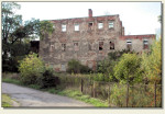
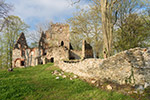
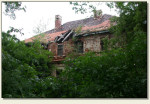
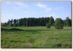
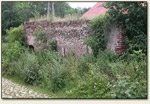
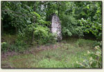
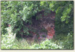
Kłaczyna lies 8 km north-east of Bolków. If you enter Kłaczyna from the side of Roztoka, you ought to turn right in Kłaczyna to Sokola and then turn left into a side road. You must drive down that road around 300 m and turn right into the field road leading to the former PGR (state-owned farm). There on the square on the left side in thicket there is an island, and the ruins on it.
Historical outline:
Former name: Kauder
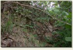
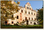
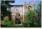
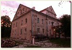
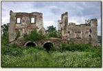
The castle in Kłaczyna did not wait any research thus knowledge on it is poor. Date of erection of the building nor its founder are unknown. It is assumed that the castle arose in the XIVth or at the beginning of the XVth cent. Already in the XVIth cent. it was demolished during Hussite wars, after which it was rebuilt as Renaissance residence. In the middle of the Thirty Years’ War the construction was destroyed again and this time its rebuilding was not undertaken.
Pictures:

Nearest castles:
Polish castles - homepage
© 2009-2025 Bartosz Jastrzębski


